Opportunity
Nearshore benthic habitats, like coral reefs and seaweed communities, are crucial marine ecosystems with rich biodiversity. Our team has developed a new technique to map these habitats, providing a comprehensive overview of their condition and spatial distribution. Unlike traditional methods, our technique offers basic geographical features and identifies different benthic habitat types. This information is essential for coastal development planning and conservation efforts. By utilizing our mapping technique, we gain a holistic understanding of these habitats, enabling informed decisions that balance economic growth with environmental conservation. Our innovative approach represents a significant advancement in nearshore benthic habitat studies, enhancing development in ISO standards and Marine Citizen Scientists engagements and contributing to sustainable management and development of the underwater environment.
Technology
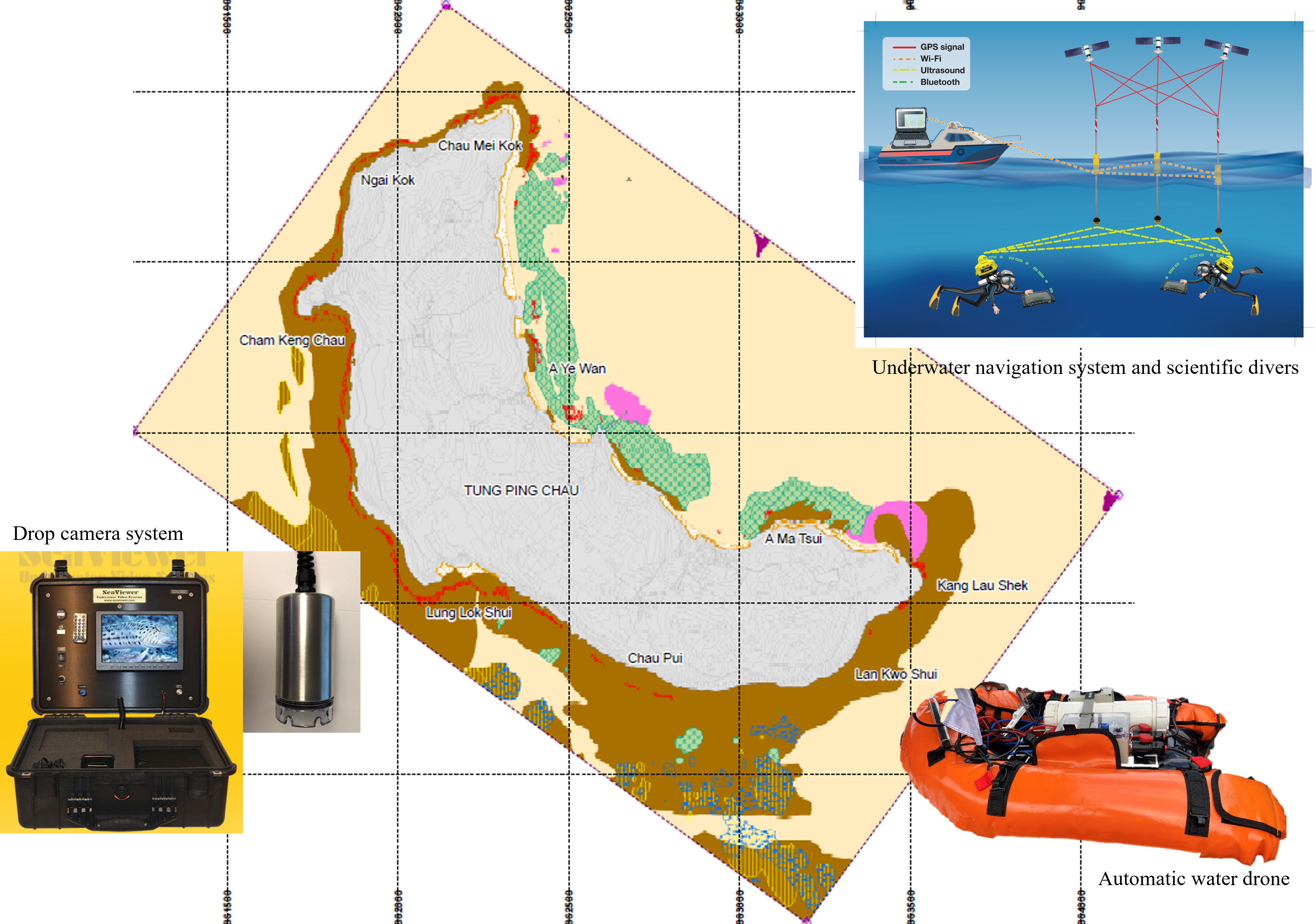
Our innovative technology integrates several key components, including a drop camera system, automatic water drone, underwater navigation system, and scientific divers, to conduct mapping surveys of nearshore benthic habitats. With this multifaceted approach, we can map large-scale underwater habitats with high flexibility to customize combinations of the aforementioned gears, enabling us to handle various scenarios, including turbid waters, shallow-water benthic habitats, or complex benthic topography, we can adapt our approach accordingly. Furthermore, our mapping protocol offers the flexibility to generate results with different resolutions to the specific needs of our customers, ranging from site exploration for management purposes to in-depth scientific studies. By tailoring our outputs to meet these diverse requirements, we empower stakeholders to make informed decisions and advance our understanding of nearshore benthic ecosystems.
Advantages
- Ability to provide large-scale benthic habitat map
- Capability of surveying different underwater environments
- Providing comprehensive review of benthic habitat
Applications
- Scientific study
- Environmental impact assessment
- Marine spatial planning
- Underwater mapping specialty training program
- Marine Citizen Scientists engagements